Signposted ski tours on groomed slopes
The signposted ski tours on the resort’s groomed slopes take you to the Gaisberg, the Bichlalm (along ski route 52) and, along ski route 56, to the Schwarzkogel and Resterkogel mountains. KitzSki, Kitzbühel Tourismus and the Kitzbüheler Alpen tourist association have established the routes to cater for the recent trend towards ski touring on groomed slopes.


Route 1 Gaisberg
A demanding ascent with a flat start, followed by a continuous increase in altitude. The steepest part is in the middle of the ascent. Provided that there is enough fresh snow, you can take the forest path through the woods to bypass it.
In the upper third, the route becomes gentler again. The well-signposted trail follows the piste boundary to the top station of the Gaisberglift chairlift.
In the upper third, the route becomes gentler again. The well-signposted trail follows the piste boundary to the top station of the Gaisberglift chairlift.
Route length
1.2 km
Difficulty
Walking time
1.5 h
Starting altitude
840 m
Target point
1260 m
Height difference
420 m
Parking
free
Route 1 Bichlalm
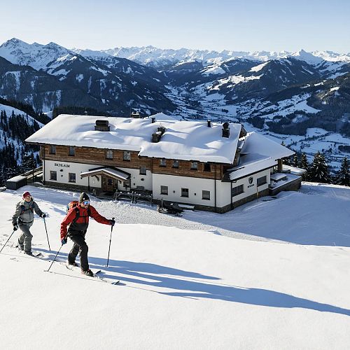
An ascent at a pleasant incline for ski tourers on groomed slopes. Ideal for gentle tours and beginners. The trailhead is located at the end of the piste, opposite the Bichlalm chairlift mid-station, and the route takes you along ski run 50.
At the beginning of the ascent, you cross open meadows with splendid views. Following a brief stretch of forest, you re-enter open terrain with lovely views about half an hour before reaching the Bichlalm. Continue along the forest path, occasionally leaving the piste, to reach the Bichlalm restaurant.
At the beginning of the ascent, you cross open meadows with splendid views. Following a brief stretch of forest, you re-enter open terrain with lovely views about half an hour before reaching the Bichlalm. Continue along the forest path, occasionally leaving the piste, to reach the Bichlalm restaurant.
Route length
2.4 km
Difficulty
Walking time
1.5 h
Starting altitude
1150 m
Target point
1600 m
Height difference
450 m
Parking
free
Ascent route 1a Stuckkogel
A pleasant ski touring ascent, treating you to delightful landscapes along ski route 52. From the Bichlalm top station, a snowcat track takes you near the Stuckkogel summit (1,880 m).
The ascent follows the groomed track. On the first 100 metres after leaving the Bichlalm, you can bypass the steep section on a zigzag route provided that there is enough natural snow. If visibility is poor beyond the forest boundary, we recommend that you do not continue the ascent.
The ascent follows the groomed track. On the first 100 metres after leaving the Bichlalm, you can bypass the steep section on a zigzag route provided that there is enough natural snow. If visibility is poor beyond the forest boundary, we recommend that you do not continue the ascent.
Route length
1.2 km
Difficulty
Walking time
1 h
Starting altitude
1600 m
Target point
1880 m
Height difference
280 m
Route 1b Hochetzkogel
If you want to reach another summit with impressive views after your ascent to the Bichlalm restaurant, you can continue to the Hochetzkogel mountain. It will take you about half an hour to get there.
Continue along ski route 52, following the trail towards the Stuckkogel. After about 400 metres, the route forks to the left, taking you to the Hochetzkogel. From here, a gentle incline takes you across the mountain ridge, treating you to sweeping views en route. You will reach the summit in about 15 minutes.
Continue along ski route 52, following the trail towards the Stuckkogel. After about 400 metres, the route forks to the left, taking you to the Hochetzkogel. From here, a gentle incline takes you across the mountain ridge, treating you to sweeping views en route. You will reach the summit in about 15 minutes.
Route length
0.6 km
Difficulty
Walking time
0.5 h
Starting altitude
1600 m
Target point
1740 m
Height difference
140 m
Route 1 Schwarzkogel
Beautiful ascent in the far part of the Spertental valley The trail starts at the practice lift in Aschau and follows the left boundary of the ski piste. The entire ascent follows ski route 56, so there will be much less oncoming traffic from downhill skiers and snowboarders than there would be on a piste.
Long stretches of the ascent route take you through the forest. At an altitude of 1,340 metres, it crosses into the Usterkar on the Aschau high-altitude summer trail. It then continues along the mountain ridge, treating you to views of the Usterkar pastures. The ridge takes you to the Hochsaukaser/Hieslegg top stations.
Additional entry route to the Schwarzkogel - Aschau piste ski tour:
Immediately from the bus turnaround area (near the Aschauer-Hof and Gredwirt) the route access leads via the slope ramp between the houses for approx. 200 m to the main route (signposted). The ski bus stop is thus directly at the starting point of the route. The entry point is marked with a trailhead info-board incl. route info and altitude profile.
Bypasses in steep piste areas:
In the upper third of the ascent route 2 - Schwarzkogel, depending on the snow conditions it may be necessary to bypass (signposted) steep piste areas in the terrain close to the piste or in the adjacent forest. Steep, sometimes confusing slope areas are bypassed at a pleasant gradient.
Route length
4.3 km
Difficulty
Walking time
2.5 h
Starting altitude
1000 m
Target point
1920 m
Height difference
920 m
Parking
Aschau practice lift
Route 1 Resterkogel
A pleasant ascent with few piste crossings and lovely views during the final steep, taking you to the summit of the Resterkogel. After a pleasant start away from the busy pistes, you follow the quiet ski route 70a. The route crosses the piste after about 20 minutes.
Continue along the right piste boundary and head into the forest. After a left turn, follow the attractive, straight route up to the Moseralm restaurant. Around the Moseralm, the trail switches to the left side of the piste. Leaving the piste, it takes you along the well-signposted ascent route towards ski run 77. Continue along the right piste boundary to reach the Resterkogel summit in about 20 minutes.
Continue along the right piste boundary and head into the forest. After a left turn, follow the attractive, straight route up to the Moseralm restaurant. Around the Moseralm, the trail switches to the left side of the piste. Leaving the piste, it takes you along the well-signposted ascent route towards ski run 77. Continue along the right piste boundary to reach the Resterkogel summit in about 20 minutes.
Route length
3.8 km
Difficulty
Walking time
2.5 h
Starting altitude
1270 m
Target point
1870 m
Height difference
600 m
Parking
Resterhöhe chairlift
Rules of conduct for ski tourers
- 1. Please observe warnings and local rules
- 2. Stay off a piste or section of a piste if it is closed. The use of snow groomers – particularly when cable winches are involved – or the use of explosives for avalanche control, etc. can cause life-threatening situations. Pistes may therefore be closed for safety reasons while the work is carried out.
- 3. Climb the piste only at the side and in single file.
- 4. The pistes should only be crossed at places that are clearly visible and with enough distance from one another.
- 5. Ski only around the edge of pistes that have just been groomed. Tracks that have frozen solid over night can severely affect the quality of the pistes.
- 6. Leave the pistes at the designated time (depending on place!)
- 7. Make yourself visible. Use headlights, reflective clothing etc. if it is dark or there is poor visibility.
- 8. If there are pistes which are specially designated for tourers, always use these.
- 9. Do not take dogs onto the pistes.
- 10. Use designated parking spaces and pay any parking fees.

Free of charge: 5-part 1x1 avalanche seminar (online)
Keen to learn how to properly ski tour and traverse the ski routes? Or perhaps you would like to know what the term 'Avalanche Emergency' means? This avalanche seminar is offered by Kitzbühel Tourismus and KitzSki. It is organised by Bergsport Überall and the Kitzbühel mountain guides.


